|
|
|
View The Images 1962
New Jersey Shore - Small Format 1962
New Jersey Shore - Large Format |
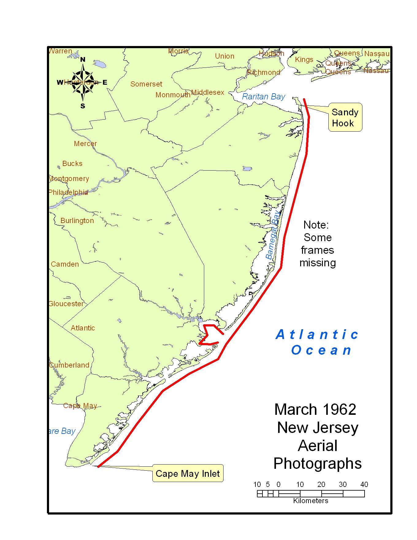
Approx geographic coverage: Photograph date: 15, 25, and 28 March 1962.Aerial flight service: U.S. Coast and Geodetic Survey. Source of original images: Photographic archives of the Beach Erosion Board (predecessor of the former Coastal Engineering Research Center), presently stored at the Coastal and Hydraulics Laboratory, Engineer Research and Development Center, in Vicksburg, Mississippi, USA. Original image condition: Variable. Printed on double-weight glossy paper. The printing date is unknown. Supplemental Information: These photographs were taken after the infamous Ash Wednesday northeaster of March, 1962, which caused extensive beach erosion and property damage along the Atlantic Seaboard. These digital files have not been orthorectified or projected. Some frames are missing, and coverage of the New Jersey shoreline is not complete. Digital files are labeled with a three-digit number which starts at Cape May in the south and increases northward. A second four-digit number corresponds to the Coast and Geodetic Survey frame number, which is printed on each photograph. Because some frames are missing, the three-digit counter has gaps in the numbering in case the missing photographs can be recovered in the future. The flights inland from the ocean coast, around Brigantine Inlet, Great Bay, and Little Bay, have been labeled with a counter "Bayxx". Photograph altitude approx 2,700 m, scale not listed. Most photographs taken between 11:00 and 13:00, assumed local eastern time zone. Lens No. 297, focal length 152.29 mm. Total number of frames: 126. Some frames show streaking from static electricity, and some frames have a faint bulls-eye target pattern. Disposition of original negatives: Unknown Alternates sets of prints: None known SCANNING INFORMATION: Scanner: UMAX PowerLook 2100XL FOR MORE INFORMATION: Andrew Morang, Ph.D. Tel voice: 601-634-2064 Email: andrew.morang@usace.army.mil
|