|
|
|
|
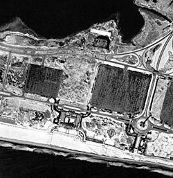
These images feature the South shore of Long Island, New York, from near the west end of Jones Beach to Sunken Forest on Fire Island, Long Island, New York (approx 10 miles). Photograph dates: January 28, 1942. Image Source:
Photographic archives of the Beach Erosion Board (predecessor of the Coastal
Engineering Research Center), supplied by Ms. Lynn Bocamazo, U.S. Army
Corps of Engineers, N.Y. District. Label on one image states "B.E.B.
Accession No. 72C." Numbering Convention: Original frames labeled M49-1 to M49-69. Digital images are labeled from west to east, beginning at Jones Beach near the Wantagh Parkway and ending at Sunken Forest on Fire Island. Scale: 1 inch = 700 feet Tide Condition: Flood - L.W. (+1.0) at 12:00 noon Gauge Reading: At 13:10 = +1.5 M.L.W.; at 14:05 = +2.0 M.L.W. (gauge location not specified) Wind Speed:
33 mph north Scanning Date: June 2003 File Names: Based on date and image number, with location description if applicable. The images are numbered sequentially from west to east starting with northernmost flight line. Contrast adjustments:
Gain and contrast adjusted to emphasize features on the beach. Minor contrast
adjustments by Andy Morang to improve features on beaches. Adjustments
made with Paint Shop Pro v. 7.0. |