
Mokapu to Makapu'u (M2M) RSM
Purpose: This study:
(1) Documented long-term trends in wave climate for the windward side of O'ahu, Hawai'i;
(2) Developed a regional sediment budget and a Geographic Information System (GIS) for three interconnected littoral cells along the southeast O'ahu coast;
(3) Identified suitable sand sources; and
(4) Developed/calibrated a sediment transport model for the region.
The final products from this study are a sand source inventory, Regional Sediment Management (RSM) plan, and a web-enabled GIS platform for the Mokapu to Makapu'u (M2M) Region.
Main Issue: The M2M Region is located
on the southeast shoreline of the island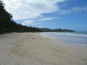 of O'ahu, Hawai'i. There are three littoral cells, Kailua in the north,
Lanikai in the middle, and Waimanalo in the south part of the study area.
There are geologic controls (both sub-aerial and offshore) affecting sediment
transport within these cells. The offshore region is a sloping reef
along which waves break on its outer edge. Waves are depth-limited by
the reef as they approach the shoreline. The cells are not believed to
share sediment with each other. The long-term average rate of shoreline
retreat is nominally 2 feet/year. Long-term (decadal or more) shifts in
wind, wave direction, and wave period may shift sediment transport patterns
and magnitudes. As a result, sediment transport processes of these
beaches are difficult to understand, and RSM solutions are not readily
apparent. In addition, sand sources for this region have not been
identified.
of O'ahu, Hawai'i. There are three littoral cells, Kailua in the north,
Lanikai in the middle, and Waimanalo in the south part of the study area.
There are geologic controls (both sub-aerial and offshore) affecting sediment
transport within these cells. The offshore region is a sloping reef
along which waves break on its outer edge. Waves are depth-limited by
the reef as they approach the shoreline. The cells are not believed to
share sediment with each other. The long-term average rate of shoreline
retreat is nominally 2 feet/year. Long-term (decadal or more) shifts in
wind, wave direction, and wave period may shift sediment transport patterns
and magnitudes. As a result, sediment transport processes of these
beaches are difficult to understand, and RSM solutions are not readily
apparent. In addition, sand sources for this region have not been
identified.
Proposal:
Task 1 - Develop long-term wave climate
From observations of shoreline position on the northeast side of O'ahu, it appears that there is a long-term trend (20 or more years) of erosion and accretion. These cycles of beach change may be caused by shifts in wave climate, including multi-decadal shifts in storm activity associated with the Pacific Decadal Oscillation. Task 1 will utilize or generate updated Wave Information Study hindcast data for the project area. Directional wave buoy data are available for the years 2000 - 2002, and non-direction wave buoy data are available for more than 20 years. These data will be used for validation of the hindcast data. This task will provide a regional wave climate for Task 5, Regional Shoreline Modeling.
Task 2: Near-shore circulation
Because waves are depth-limited as they approach the study area, it is believed that near-shore circulation (wave- and wind-induced) may be a significant process controlling sediment transport. This task will setup and run the Advanced Circulation Model for the study area. There are no current data available for validation; thus, three separate drogue studies are planned under a range of wave and wind conditions.
Task 3: Geomorphic analysis of study area
Historical shoreline position, beach profile, aerial photography, bathymetric, and geologic information for the study area will be evaluated to identify (a) long-term trends in shoreline position; (b) long-term trends in bathymetric change; (c) locations with possible sources of beach nourishment material; and (d) geologic controls on littoral processes. Historical shoreline position data are available from the University of Hawai'i and the U.S. Army Corps of Engineers Technical Integration Branch (TIB). Sand samples will be taken for each littoral cell, and sediment cores will be collected and analyzed for possible offshore sources of material. Because of the low hardness value of the sediment, it is possible that abrasion or mechanical disintegration is a significant process in shoreline retreat. The abrasive characteristics of beach sediments will be quantified. This task will provide data for Task 4, development of the regional sediment budget, and the calibration and verification dataset for Task 5, regional shoreline modeling.
Task 4A: Develop a regional sediment budget
Volumetric change for historical and present-day time periods will be developed for the active littoral region. These data, together with knowledge of the long-term wave and wind climate (Task 1) and regional shoreline modeling (Task 5), will be used to develop sediment budgets for each littoral cell. Sediment sources and sinks will de defined and quantified. A regional budget will be developed, including an assessment of whether long-term sand sharing between littoral cells occurs. The regional sediment budget will be used to develop a Regional Sediment Management plan, and a with-project regional sediment budget will be forecasted.
Task 4B: Develop a web-enabled GIS platform
A web-based GIS platform will be developed for the M2M region. The GIS will contain geo-referenced maps, attributes, and metadata corresponding to M2M RSM requirements. Aerial photography, digital elevation models (DEMs), geotechnical information, survey data, wave parameters, and other pertinent geo-referenced information will be automated via the GIS. The GIS will utilize state-of-the-art web-enabling software to provide real-time access of products through the Internet.
Task 5: Regional shoreline change modeling
The regional shoreline change model presently in developmental testing, Cascade, will be calibrated and verified for the study region. The wave climate produced in Task 1 will drive the model, and shoreline positions, geologic controls, and bathymetric contours defined in Task 3 will be used for calibration and verification. The regional modeling will work hand-in-hand with development of the regional budget (Task 4A). A RSM plan will be developed using results from each task. This RSM plan will document long-term trends in beach change, and identify possible sources of sand, to management of sediment within the region.
Task 6: Sand source investigations
Sand sources will be identified in areas offshore and upland of the region. Research and development of sand manufacturing techniques will also be carried out under the task.
Schedule and Funding: The RSM demonstration project for the M2M Region will take four years and $1.25 million to complete.