|
|
|
|
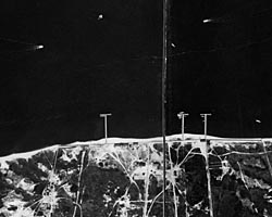
These images feature the Fire Island Inlet of Long Island. Photograph dates: August 20, 1937. Image Source:
Photographic archives of the Beach Erosion Board (predecessor of the former Coastal Engineering Research Center), presently stored at the Coastal & Hydraulics Laboratory, Engineer Research and Development Center, in Vicksburg, Mississippi, USA. Identification Label: (VI 876K 97th)(8-20-37-11:55A) (12-8400) FIRE ISLAND COAST EROSION Mosaic: Photographs have been cut and mosaiced onto cardboard backing. Supplemental Information: These files have not been orthorectified or projected. The images are numbered sequentially from west to east, Fire Island first, then proceeding east to Saltaire. Identification label shows: VI 876K 97th)(8-20-37-11:55A) (12-8400) FIRE ISLAND COAST EROSION. This indicates use of a 12-inch lens at 8,400 ft altitude. Contrast adjustments:
Total tonal range based on the histogram of pixel intensity for overall photographic image (backing and borders excluded). Typically, the low, mid, and high values settings were set automatically by software. |