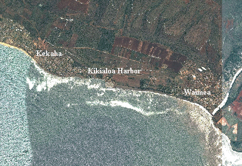
The Kekaha Regional Sediment Management project area extends from the mouth of the Waimea River westward along an approximately 3.5 miles of Pacific Ocean shoreline to Kala Road. The towns of Waimea and Kekaha border the project area to the east and west, respectively. The project area also includes the Waimea River watershed in recognition of the importance of establishing a "mountain-to-the-sea" or "ahupua'a" approach to sediment management in the region. The predominant source of sediment in the region is the Waimea River watershed. Sediment originating from the watershed is discharged from the river mouth during periods of significant flow. Once in the littoral system, the predominate direction of sediment transport is to the west. Kikiaola Light Draft Harbor is located along the central portion of the region's ocean shoreline. The harbor has interrupted the flow of westward directed sediment since it was constructed in 1959. Investigation of sediment bypassing around the harbor and onto the downdrift shoreline is a major component of the Kekaha RSM project.