|
|
|
View The Images 1953
Grande Isle Area, Louisiana Shore - Small Format 1953
Grande Isle Area, Louisiana Shore - Large Format |
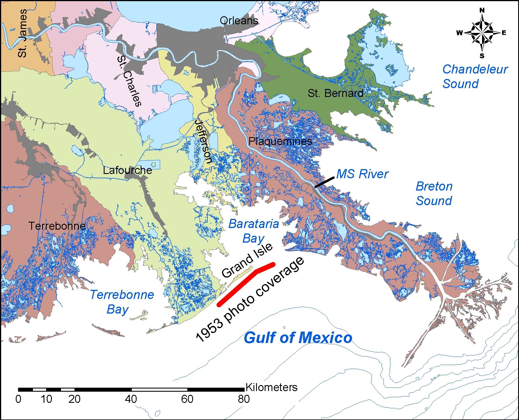
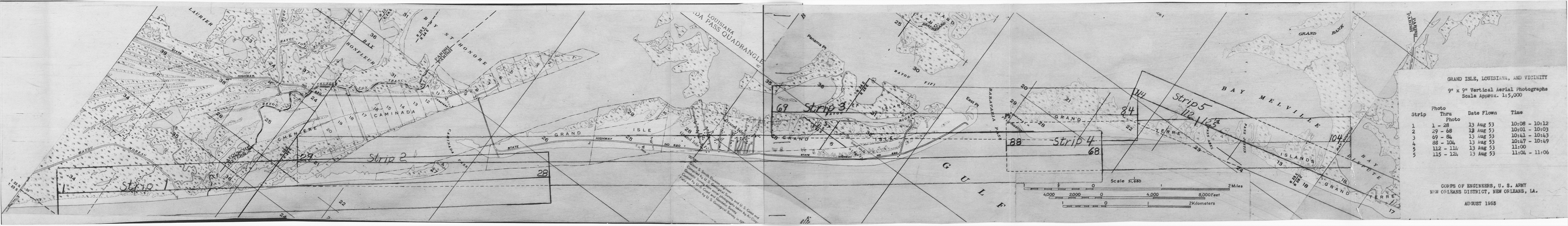
Location: Gulf of Mexico shore of Louisiana near Caminada, Grand Isle, and Grand Terre.
Approx geographic coverage: Photograph date:
13 August 1953. Abstract:
These are black and white aerial photographs of Caminada, Grand Isle, and Grand Terre, Louisiana, USA. Photograph date is 13 August 1953. Flight times: Group 1, 10:08 to 10:12; Group 2, 10:01 to 10:03; Group 3, 10:41 to 10:43; Group 4, 10:47 to 10:49; Group 5, 11:00 (frames 112 - 114) and 11:04 to 11:06 (remaining frames). Time zone not specified. Scale: approx. 1:5000.
Aerial flight service:
Unknown. Source of original
images:
Photographic archives of the Beach Erosion Board (predecessor of the Coastal Engineering Research Center), presently stored at the Coastal and Hydraulics Laboratory, Engineer Research and Development Center, in Vicksburg, Mississippi, USA.
Original image
condition:
Variable. Some prints are low contrast and streaked and show evidence of insufficient development. The prints themselves do not appear to have faded over time. Printed on double-weight semi-gloss paper. he printing date is unknown but believed to be 1953.
Supplemental Information:
These files have not been orthorectified or projected. Frames 1-21 to 1-29 were not scanned because they included mostly open water.
Disposition of original negatives: Unknown Alternates sets of prints: None known SCANNING INFORMATION: Scanner: UMAX PowerLook 2100XL FOR MORE INFORMATION: Andrew Morang, Ph.D. Tel voice: 601-634-2064 Email: andrew.morang@usace.army.mil |