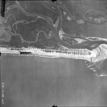
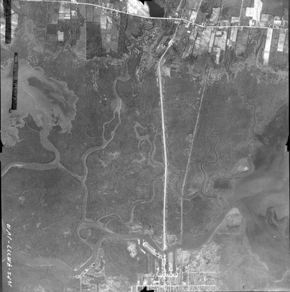
New Jersey Shore, 1944
Atlantic shore from Cape May to Normandy Beach · 104 frames · select a photo to view and zoom.
About these photographs
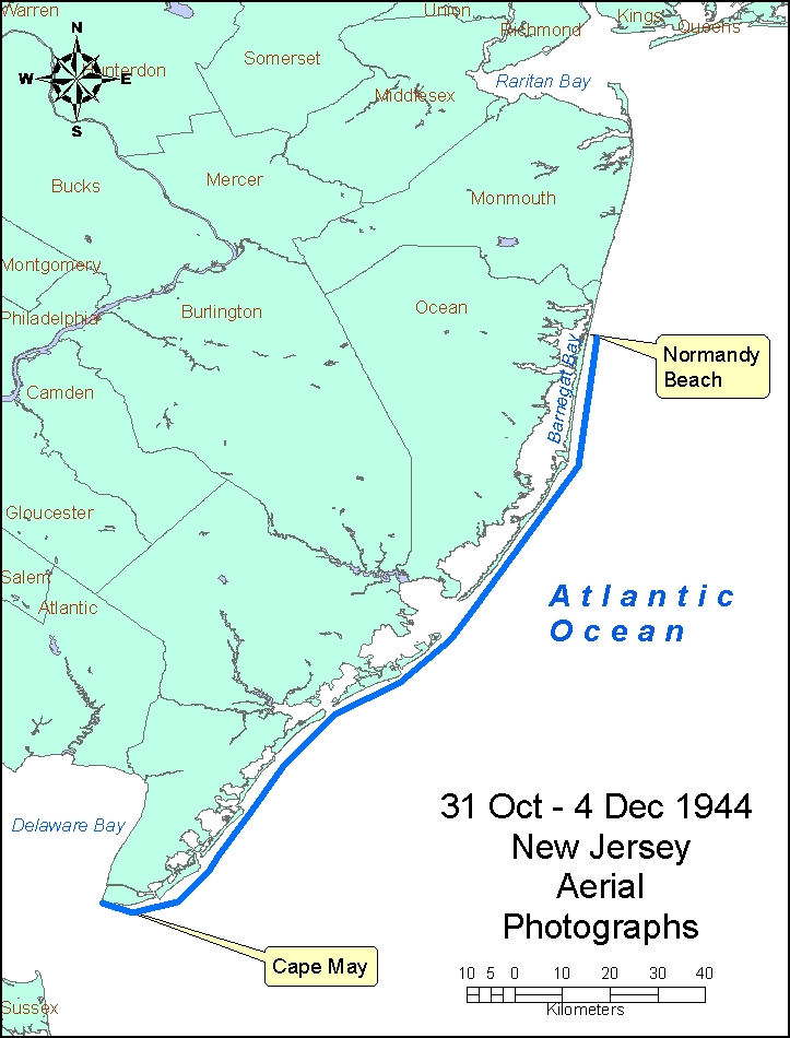
- Location
- Atlantic shore of New Jersey from Cape May to Normandy Beach.
- Coverage
- South: 38.93°N, 74.98°W · North: 39.98°N, 74.07°W
- Photograph date
- 31 October - 4 December 1944.
- Aerial flight service
- Flight A, 16th Photo Squadron, US Army.
Source, condition and scanning notes
Abstract: These are historical black and white aerial photographs of the Atlantic coast of New Jersey. Photograph dates are 20 November 1944 for flight 1, 4 December 1944 for flight 2, and 31 October 1944 for flight 3, based on labels on some of the frames.The file names represent the flights. Source of original images: photographic archives of the Beach Erosion Board (predecessor of the former Coastal Engineering Research Center), presently stored at the Coastal and Hydraulics Laboratory, Engineer Research and Development Center, in Vicksburg, Mississippi, USA. Original image condition: excellent. Printed on single-weight glossy paper. The printing date is unknown but believed to be 1944.
Source of original images: Photographic archives of the Beach Erosion Board (predecessor of the former Coastal Engineering Research Center), presently stored at the Coastal and Hydraulics Laboratory, Engineer Research and Development Center, in Vicksburg, Mississippi, USA.
Original image condition: Excellent. Printed on single-weight glossy paper. The printing date is unknown but believed to be 1944.
Supplemental Information: Total flight lines: 3. Total number of frames is 104. These files have not been orthorectified or projected. Lens cone 8.25 inch, altitude: 13,750 ft. time: shown on every 5th or 6th frame. Label on first frame of series at Cape May: 16PS-4M777-IV43-10:31:1400-8.25:13,750-3856N7459W-Atlantic Coast Line, N.J., MD., & Del. Identification label shows: Project 777, Atlantic Coast Line, NJ, MD, & Del. 30 thru 31 Oct 44. flown by Flight A 16th Photo Squadron.
Disposition of original negatives: Unknown
Alternates sets of prints: None known
Scanning Information: Scanner: UMAX PowerLook 2100XL
Software: MagicScan v4.5. Contrast and gain were adjusted for most frames to emphasize beach features and preserve texture in wetlands.
Resolution: 600 x 600 dpi for TIFF files (not on the site); 600 x 600 dpi, 8 bit Grayscale for JPEG files.
Scanning date: June and July 2005.
Scanned by: Mr. Doyle Jones