|
|
|
|
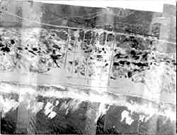
Location: South shore of Long Island, New York, from Democrat Point at Fire Island Inlet to Napeague Harbor, near Montauk Point. Photograph dates: April 11, 1939 between 2:00 and 3:00 P.M. Aerial flight service: U. S. Army Air Corps, 97th Obs. Sq. (C&A) AC., Mitchel Field, NY (based on labels on back of images). Source of original images: Photographic archives of the Beach Erosion Board (predecessor of the Coastal Engineering Research Center), presently stored at the Coastal and Hydraulics Laboratory in Vicksburg, Mississippi, USA. Original image condition: Fair. Some of these images were not adequately fixed and have faded to a low-contrast sepia color. Many are stained from the rubber cement used to fix them to the cardboard backing. Printed on single-weight glossy paper. Mosaic: Photographs mosaiced at an unknown date. No documentation is available stating what study was conducted using these images or if the results were published. Mosaiced images are shown with part of the cardboard backing. Each scan is one page of the mosaic. Label states, "B.E.B. Accession No. 74." Numbering convention: Digital images are labeled from east to west, beginning at Napeague Harbor (390411-01-Napeague) and ending at Democrat Point (390411-62-DemocratPt). Altitude, lens, time, film type: Unknown Historical note: These photographs were taken seven months after the Great New England Hurricane of September 24, 1938. Sand fences have been placed along many of the beaches. Most of the breaches that were cut during the hurricane have been naturally or artificially closed. Moriches Inlet consists of several openings through Westhampton Beach, and Shinnecock Inlet occupies approximately the same location that it currently does. To close breaches, workers from numerous state and local agencies dumped sand, tree limbs, and even car bodies into the gaps. SCANNING INFORMATION: Scanner: UMAX PowerLook
2100XL FOR MORE INFORMATION: Andrew Morang, Ph.D. Tel voice: 601 634
2064 Email: andrew.morang@erdc.usace.army.mil
|
|
1939
Fire Island Images 1939
Fire Island Images 1939
Ponds Images 1939
Ponds Images 1939
Westhampton Images 1939
Westhampton Images
|